 The Australian Hydrological Geospatial Fabric (Geofabric) tutorial series has expanded, with a further two tutorials now available.
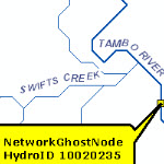
The Geofabric is a specialised Geographic Information System. It registers the spatial relationships between important hydrological features such as rivers, water bodies, aquifers and monitoring points.
Geofabric V2 includes 479 beta hydrological monitoring points in a table called Beta Surface Network Monitoring Point. These monitoring points are important reference stations for hydrological prediction and modelling purposes.
The Use the Beta Surface Network Monitoring Point table to extend node attribution tutorial describes how the table can be joined to the Geofabric Surface Network.
The National Environmental Stream Attributes is a set of lookup tables of attributes that describe the natural and anthropogenic characteristics of the stream and catchment environment at three spatial scales. The Use Environmental Stream Attributes to extend stream and catchment attribution tutorial provides examples of these lookup tables and shows how they can be joined to either the Geofabric Surface Network or Geofabric Surface Catchment.
Access the Geofabric tutorials


Article Discussion: