by Virginia Smith, Ellison Carter and James Seppi (Bridging Waters), Laura Read (Bridging Waters and Tufts University), and Fernando Salas (University of Texas at Austin)
 Over the past 20 years, more than two billion people gained access to improved drinking water resources, and 1.8 billion people gained access to improved sanitation services.* With these gains, drinking water coverage worldwide has already exceeded the United Nations (UN) Millennium Development Goal (MDG) of 88% before the target year 2015. Global sanitation coverage, currently at 63%, lags behind the UN MDG of 75%.
Though global access to improved drinking water and improved sanitation services continue to expand, progress is uneven between countries and urban and rural zones. For example, nearly half of the progress made in global sanitation coverage is attributed to achievements in 2 countries alone: China and India. Worldwide, it is estimated that 2.5 billion people still lack access to safe sanitation services, and approximately 800 million people lack access to safe drinking water.
It is not enough that MDGs be met in 2015; people need water and sanitation services they can rely on for generations to come. To assess the long-term integrity of newly developed water and sanitation services, as well as advances yet to be made, the water and sanitation development community must create a safe environment within which success and failures can be closely analyzed and discussed. Strengthening communication and information exchange between organizations increases opportunities for all stakeholders to learn from the best practices and failures of each other, and that is what Bridging Waters is all about.
Collaboration amongst the many public, private, and governmental organizations devoted to the water and sanitation development sector has, until recently, been hampered by a lack of tools to foster prudent, effective communication. These same organizations frequently initiate work within a target community without sufficient cultural, political, financial, or technical knowledge pertinent to the area.
In 2010, Virginia Smith and a group of graduate students at the University of Texas at Austin recognized the need for stronger communication among groups in similar project areas. Based on their experiences working abroad they created Bridging Waters, a 501(c)3 nonprofit organization. Bridging Waters is an organization dedicated to improving the manner in which individuals and groups in the water aid sector share information. Bridging Waters believes that communicating with others and sharing information about best practices and lessons learned can be very beneficial for completing sustainable water projects in developing countries and regions.
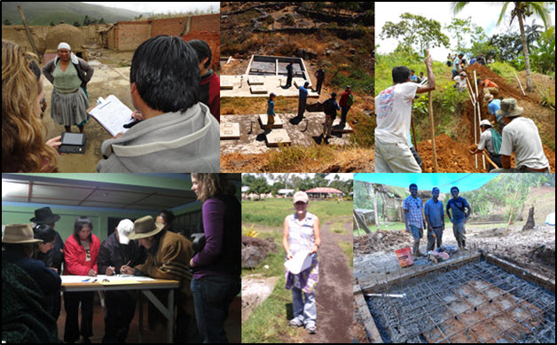
Figure 1: Members of Bridging Waters working on water projects around the world. From the top left corner going clockwise: Ellison Carter working with Water for People in Bolivia; James Seppi working with Engineers Without Borders in Peru; Elliott Gall working with Engineers Without Borders in Panama; Fernando Salas working with Engineers Without Borders in Panama; Virginia Smith working with Peace Corps in Samoa; and Laura Read working with Engineers Without Borders in Peru.
To facilitate information sharing and support the establishment of successful and sustainable water projects and programs in developing regions of the world, Bridging Waters is developing an interactive website for individuals and groups working on water projects to share their information and ideas. This website will provide basic resources (e.g., how to construct a spring box; how to design a water filter; or best management strategies in a particular region), a discussion board, and most importantly, a database of water projects. Through these services Bridging Waters hopes to create an information portal to aid water project development and sustainability. The more information we gain by learning from each other, the more effective our work in the water and sanitation development sector can be.
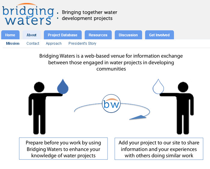
Figure 2: Bridging Waters website, www.bridgingwaters.org.
The Bridging Waters project database will be comprised of geospatially-enabled project information so that development workers and volunteers can find and learn from projects similar to their own. As a first effort, Bridging Waters has been working with Tufts University and the University of Texas at Austin (UT-Austin) to map the locations of water-based projects all around the world. Inspired by the Water Youth Initiative at the 6th World Water Forum in Marseille, France, Laura Read of Tufts University and Fernando Salas of UT-Austin created a map called WaterDots. WaterDots is an online map and map service available through ArcGIS Online. As part of the online map, WaterDots ingests existing map services available through both World Water Online and the ESRI Hydro Resource Center (see blog posts at by Steve Kopp, Caitlin Scopel and Dan Siegel about World Water Online data services within the ESRI Hydro Resource Center). This tool not only creates a map or network of water aid projects, but also connects people working on those projects with basic hydrologic data around the world that can, otherwise, be difficult to obtain (e.g. detailed river networks, monthly precipitation, evaporation, etc.). Currently, the map contains the locations of all Engineers Without Borders-USA projects, and the group is in ongoing discussions with the Water and Sanitation Rotary Action Group (WASRAG) to integrate their projects into WaterDots as well.
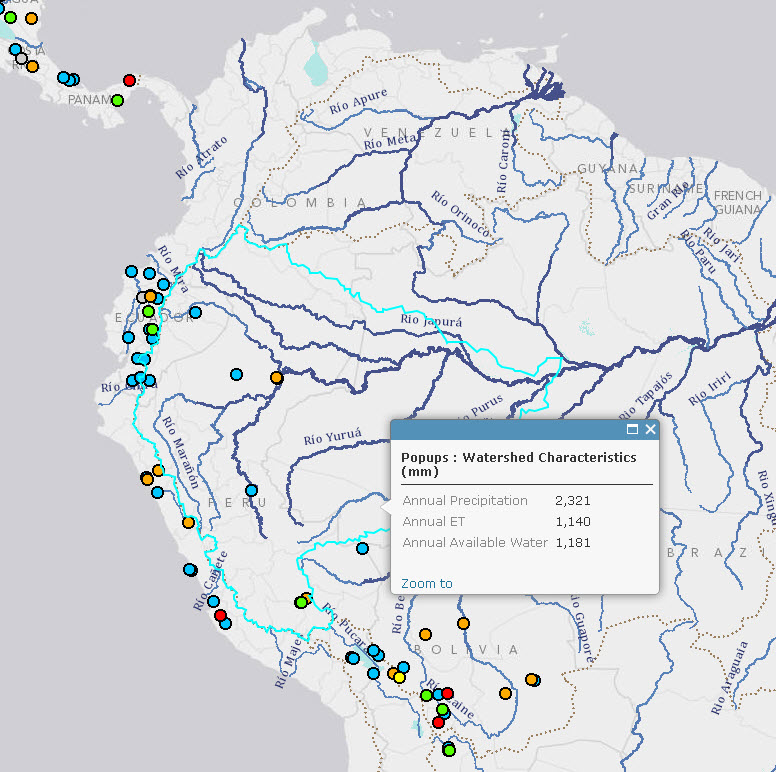
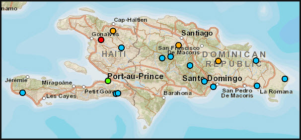
Figure 3: The WaterDots Map on ArcGIS Online. This example shows several projects in Central and South America. The highlighted portion of the map shows the basemap, with information about the Amazon watershed.
Bridging Waters is leveraging the WaterDots map service to create a centralized project database and interactive map within its website. The current prototype interactive map, developed by James Seppi, is built with ESRI’s ArcGIS Javascript API and the WaterDots map service. ESRI’s JavaScript API makes online mapping relatively uncomplicated because it is capable of using and displaying a variety of map service formats. In addition, the JavaScript API Sample gallery and documentation provides Bridging Waters with the necessary resources to update the map quickly. Future development of the Bridging Waters database will involve an online survey that development workers can use to input detailed information about projects on which they have served. With this detailed information, other users will then be able to search the database by faceted criteria such as location, project type, technologies used, environmental conditions, and community factors, among others.
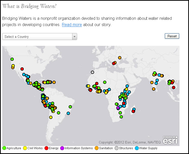
Figure 4: A screenshot from of the WaterDots-based map on the Bridging Waters website.
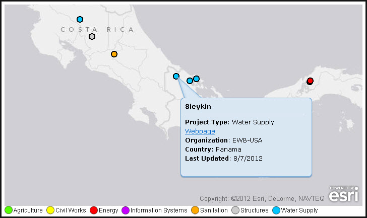
Figure 5: A WaterDots project in Panama done by Engineers Without Borders-USA.
ArcGIS is the ideal platform to achieve the goals Bridging Waters has outlined, as it provides the best tools and solutions for creating shareable maps with multiple projects from a database. ArcGIS Server in the Cloud will allow Bridging Waters to make their data publically available without the burden of managing server hardware and software resources. This will allow Bridging Waters to focus on its core goals of connecting water development workers while continuously updating its database with new data. Moreover, the ESRI community welcomes groups like Bridging Waters, who, similarly to World Water Online and the Hydro Resource Center, are interested in bringing together data and ideas that seek to foster sustainable management of water.
Water is essential to humans and the environment on a local scale, in every community around the world. Engineers, scientists, and policy makers all struggle to understand the complexity of water management and seek solutions that are tried and tested by others. Using a map to serve as the main interface for the Bridging Waters information portal, this fundamental visual aid connects people and projects around the world to one another. With our international approach to water and sanitation development data collection, supported by advanced mapping and data services, we can create an online community that shares failures and solutions while facilitating networking among dedicated individuals and organizations that are carrying out water development projects and programs worldwide.
For more information, please visit www.bridgingwaters.org or visit the WaterDots map in ArcGIS Online.
*2012 monitoring report on global water supply and sanitation issued jointly by the World Health Organization (WHO) and the United Nations International Children’s Emergency Fund (UNICEF)


Article Discussion: