Flickr is one of the most popular photo sharing sites available, hosting well over 6 billion images. Here’s how to use your Flickr photos in your ArcGIS Online web maps.
The trick with Flickr is getting the full URL to the source photograph. That’s not obvious to find since Flickr community guidelines require a link back to the original Flickr photo page so the photographer and other information about the photo is available. But you’ll find the link to the source photo in the embed code when sharing is enabled.
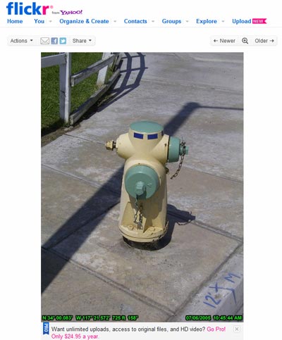
Here’s the Flickr photo we’ve added to our account that we’d like to use in our map:
 At the top of the photo click Share, and look for the Grab the HTML/BBCode option:
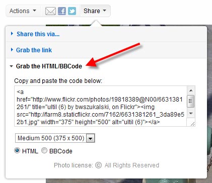
In the HTML you’ll find the source for the image. Look for the full URL path to the image file. Ours looks like this:
http://farm8.staticflickr.com/7017/6631381167_2929697926.jpg
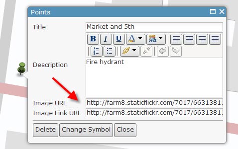
Copy and paste that into your map note or pop-up configuration. Here’s where you can place the URL in a map note:
And here’s how the saved pop-up looks when clicked:
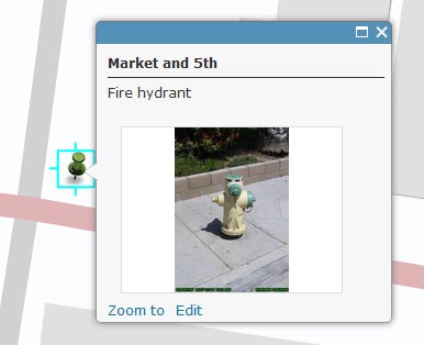 By adding the same URL to the Image Link URL you can display a larger version of the photo when the pop-up thumbnail is clicked. You can use the same technique to add Flickr photos to feature layer pop-ups. To add multiple photos, you can create a TXT or CSV file with Flickr photo links along with their location (address or lat/long) and add them in batch from a file.
For more information see our earlier post covering tips and best practices for displaying photos in pop-ups and the Configuring pop-up windows help topic.
(Thanks to Pat Dolan, Esri solutions lead, for the tip).


Commenting is not enabled for this article.