During the Emergency Management Special Interest Group (SIG) Meeting (sponsored by IBM) at the Esri International User Conference I gave a talk on Tools for Social Media. Many of you were interested in the tools so I wanted to share the links via this blog.
Public Information Map
The first tool we talked about was the Public Information Map. This application is something that we have developed over time to include live mapping in support of our Disaster Response Program website. The Public Information Map is available as a template that you can download and configure.
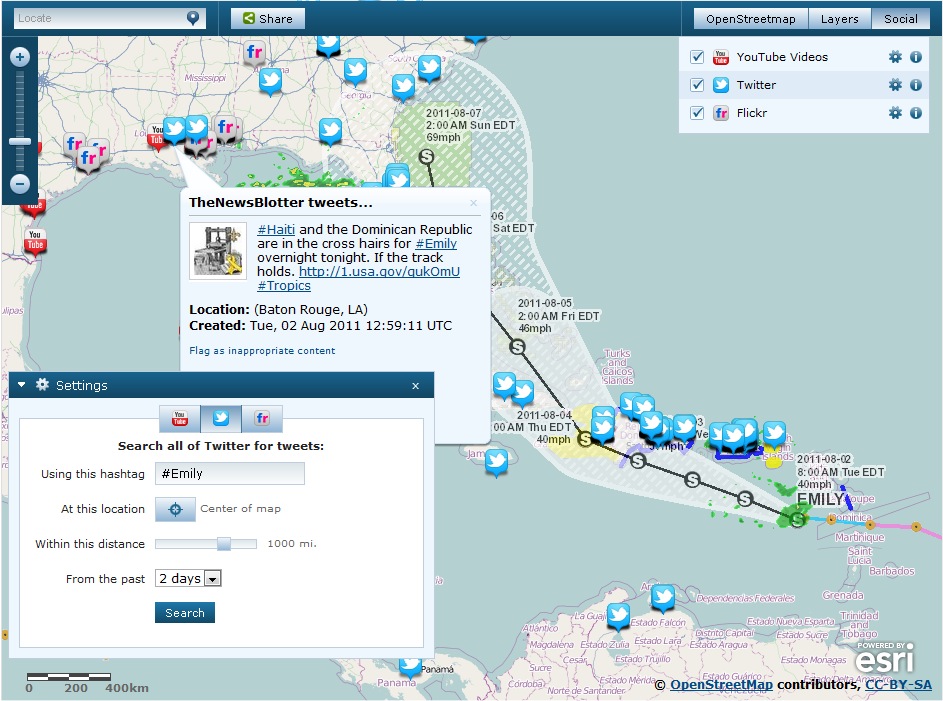
There are many live examples of the Public Information Map that you can visit now with current information in support of our Disaster Response Program. The Public Information Map Template has been configured for:
- Earthquakes
- Flooding
- Severe Weather
- Wildfires
- Hurricanes & Tropical Cyclones
- Global Incident Viewer
- Current Event Maps
Also note that Jeff Archer (@vee_dubb) wrote a nice blog post on lessons learned applying this template.
Social Media Widget
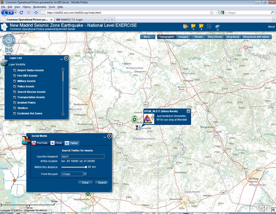
Social Media is on a path to evolve to become another critical source of situational awareness just like weather. A Social Media Widget has been developed to be able to bring in Social Media into command and control applications, such as the Common Operational Picture Template.
Here is an example of the Social Media widget in action during the National Level Exercise we tracked the Commonwealth of Kentucky Division of Emergency Management Public Information Officer as she traveled around the State with the Brigadier General:
ArcGIS.com Tweet Mapping Template
As described in this previous ArcGIS Online blog, you can add Twitter to your ArcGIS.com map. Simply create your ArcGIS.com web map and then share using the Azure Twitter template. Here’s an example from the #EsriUC and the 5K Fun Run/Walk:

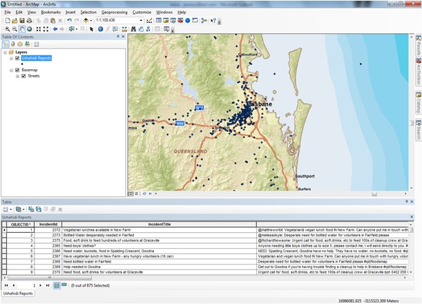
Ushahidi ArcGIS Desktop Add-In
Often times during disasters we will stand up a Trends Map, such as this example from Japan, where we can look at the density of Ushahidi reports visualized as a heat map. During the flooding in Australia, we took this one step further and put together an ArcGIS Desktop Add-Infor Ushahidi data so you could export Ushahidi data in to a local geodatabase to do further analysis. The Add-In for Australia floodingexample can be found on ArcGIS.com.
We are actively working with the Ushahidi community to make this tool more generic and broadly available. Stay tuned for more information.
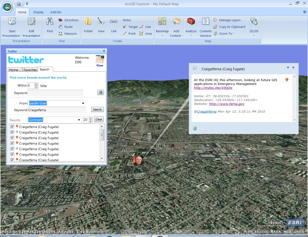
ArcGIS Explorer Twitter Add-In
The ArcGIS Explorer Twitter Add-In was updated just before the User Conference. Here’s an example screenshot of a slightly earlier version of the tool from when FEMA Administrator Craig Fugate (@CraigAtFEMA) came to visit Esri last year.
There you have it, a tour of some of the Social Media Tools
and Templates from Esri that we discussed during the Emergency Management SIG. This is an area that we continue to do more
research and development on. Watch
Twitter and the blogs for more updates!


Commenting is not enabled for this article.