By Aileen Buckley, Mapping Center Lead

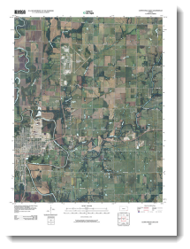
The U.S. Geological Survey, America’s national mapping agency, announced recently that they are scanning and georeferencing historical USGS quadrangles.
“The Historical Quadrangle Scanning Project (HQSP) is scanning all scales and all editions of approximately 250,000 topographic maps published by the U.S. Geological Survey (USGS) since the inception of the topographic mapping program in 1884. This scanning will provide a comprehensive digital repository of USGS topographic maps, available to the public at no cost. This project serves the dual purpose of creating a master catalog and digital archive copies of the irreplaceable collection of topographic maps in the USGS Reston Map Library as well as making the maps available for viewing and downloading from the USGS Store and The National Map Viewer.”
For additional information contact:
G.J. Allord
National Geospatial Program
U.S. Geological Survey
465 Science Dr., Suite A
Madison, WI 53711
http://www.usgs.gov/ngpo/


Article Discussion: