By Aileen Buckley, Mapping Center Lead
Many of you have asked us about how to cite Esri or other data that you use on your maps. In this blog entry, we describe how to do that properly. As an example, we will use the data that you can access in the Esri Data & Maps Media Kit. The Esri Data & Maps Media Kit is a wonderful collection of data that is provided with the software under license. The data are listed on what is referred to as the “Redistribution Rights Matrix”. This Matrix is also located on our website at this link for the most current version of Data & Maps.
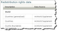
When you use the data, you should cross check each data layer and consult the Matrix for information on the Redistribution Rights. If you click on the link above and look up the data layers you are using under the appropriate category (World, USA, etc.) you will find a redistribution code on the right hand side. The definitions for the codes are located in the subsequent pages (the FAQ’s section) of that website link. Simply scroll down to find the definitions. You should be able to find the redistribution rights for any data layer you are using.
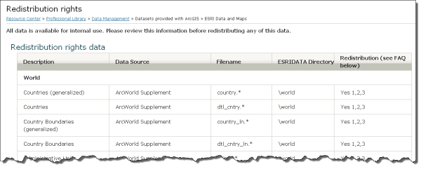
For example, if you are using the data in a hard copy, static format, you will need a “Yes 1” at a minimum or a “Yes 4” for the data layers you are using. Because this Matrix is in place for the data in the media kit, Esri does not provide formal permission grants for requests you may send us to use these data. It is up to you, the end user, to consult the Matrix and confirm that the type of use you propose is in fact permitted by the data vendor(s). Once the end user confirms that he or she has the proper rights to use the data as they have proposed, all that is required is that the data vendor be sourced for the use of the data.
The data vendor information is conveniently located on the Matrix in the second column. For example, under Canada, the shapefile “province.*” is a “Yes 1, 2” for Redistribution. You would then refer to the column “Data Source” and find that this data was provided under license by DMTI Spatial Inc. So, following this example, for the Canada layer “province.*” your attribution for the map created using this data should read “Source: DMTI Spatial Inc.” This should be done for each data layer being used to create a map.
With regard to a statement on the map or in the publication (e.g., book, article) in which the map appears, one way you could reference the use of Esri software to create your maps is a statement such as:
“Maps throughout this book were created using ArcGIS® software by Esri. ArcGIS® and ArcMap™ are the intellectual property of Esri and are used herein under license. Copyright © Esri. All rights reserved. For more information about Esri® software, please visit www.esri.com.”
Thanks to Lisa Horn for her help with this blog entry.


Article Discussion: