By Aileen Buckley, Mapping Center Lead
If you want to remove selected features from display with standard ArcMap symbol management tools, you need to use the Layer Properties to do so. Typically this might mean using a Definition Query based on a feature attribute value, or a classification scheme which excludes a range of attribute values. Cartographic representations provide you with a method for removing features from display, this method is based on graphic selection.
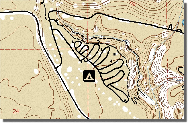
You could use this functionality in the case where you want to create a map for a time or scenario that is not reflected in your current data. For example, the Crater Lake National Park data which we use in Mapping Center is recently captured National Park Service data. If I want to re-create a Crater Lake National Park map from the 1950s, when the road and trail network was much less developed, I would need to omit the recently added trails. I don’t have data from the 1950s, or an attribute which stores the date when each road or trail was built, but by using representations to manage which features are displayed, I can still use the modern data without having to save a whole new feature class for the historic map. Here is how it works:
1. Once your layer is symbolized, right click on it and choose to convert your layer’s symbology to representations.
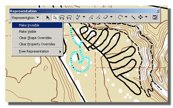
2. Start Editing and use the Representation Toolbar’s Direct Select Tool to select the features that you don’t want to display.
3. From the Representation menu, choose Make Invisible (shown below).
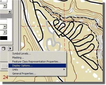
If, at a later date, you need to identify which features are invisible, or discover which features may not have a representation rule assigned, you can use the representation Display Options on the Layer Properties dialog’s Symbology tab (shown below).
This display option has the benefit of storing your choice of which features to display in the geodatabase, rather than a map document or layer file; allowing anyone who uses your data to reap the benefits of your work.


Article Discussion: